Online services that extend the capabilities of OpenStreetMap
Useful

A variety of online services rely on the data collected by the OpenStreetMap project. This article introduces you to the most useful options.
OpenStreetMap (OSM) [1] is one of the largest and most popular community web projects. In contrast to a tool like Wikipedia, however, OSM users rarely see the project's website. Instead, geo-information systems such as route planners, navigation apps and devices, or outdoor trackers integrate OSM's data as part of their own presentation.
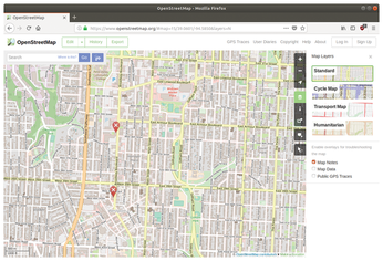
If you visit the OSM website directly, you can click on the Layers button on the right side to display alternative map forms, such as Cycle Map, Transport Map, or Humanitarian Map (Figure 1). In addition, you can display current information about the maps by checking the Map Notes checkbox. The contents are shown as soon as you mouse over or click on the little flag in the map. Many layers come with legends that you can enable by clicking on the button with the i to the right of the map.

[...]
Buy this article as PDF
(incl. VAT)